Friday, August 30, 2013

K is for KALBARRI


Wikipedia tells us that KALBARRI is a coastal town in the Mid West region of Western Australia located 592 km (368 miles) north of Perth.  The town is found at the mouth of the Murchison River and has an elevation of 6 metres (20 ft).  It is connected by public transport to Perth via Transwa coach services N1 and N2.   MOH and I used our free bus passes about 12 years ago go to Kalbarri and it was a most enjoyable holiday for us both.  We had a comfortable unit at the Kalbarri Beach Resort.


The local Aboriginal people inhabited the area for thousands of years and have a 'dreaming' story about the Rainbow Serpent forming the Murchison River as she came from inland to the coast.  The Murchison River in flood:

The first European people to visit the area were the crew of the trading ship belonging to the Dutch East India Company, the "Batavia", who put two mutinous crew members ashore at Witeecarra Creek near Bluff Point just south of the town.  They are believed to have been the first permanent European settlers to this country.

The cliffs near the river mouth were named after another trading ship. the Zuytdorp" that was wrecked there in 1712.  The area became a popular fishing and tourist spot in the 1940s and by 1948 the State Government declared it a townsite.  Lots were soon surveyed and the town was gazetted in 1952. The name Kalbarri comes from the aboriginal word for 'edible seed' and also they say from one of the locl aboriginal tribesmen.  The Murchison River is name after Sir Frederick Murchison by Lt George Gray who was shipwrecked along the coast.  This is the Zuytdorp lookout:


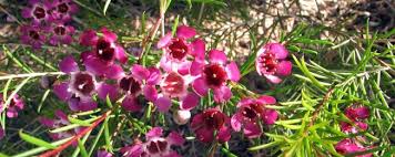
Kalbarri is geared towards tourism and fishing, with attraction including the daily pelican feeding. the Kalbarri National Park, Murchison River Gorge and the Murchison River itself.  There are charter boats that can be hired to go on to view the River.  The town attracts 200,000 tourists each year with the population of the town swelling to 8,000 during holiday seasons.

The Kalbarri National Park is home to a phenomenon of geography and geology known as the Z Bend


and "Nature's Window", a rock formation overlooking hundreds of kilometres of Murchison River.


Pelican feeding in Kalbarri started in 1970 when every morning local Cliff Ross would feed the pelicans the scraps left over after he had cleaned his morning's catch of fish.  This would happen at about 8.45 every morning before Cliff went and opened his shop 'Fantasyland' which was just across the road. On the odd occasion Cliff would be out of town and not go fishing in the morning but the pelicans knew where he went with that bucket of fish each morning so if he wasn't there to feed them they would walk or fly over the road and wait outside his house/shop.  This became a bit of a traffic hazard so eventually other locals would go feed the pelicans to keep them on  the safe side of the road (when Cliff was not there).  As Cliff got older, he was there less and less to feed the pelicans and sadly, Cliff passed away recently.  The tradition of feeding the pelicans in Kalbarri continues at 8.45 each morning, rain, hail or shine.  Run by 4 volunteers who take turns each doing a week every month, the pelican feeding has become one of Kalbarri's main tourist attractions.  If you manage to get to the Kalbarri riverfront at 8.45 each morning you will not only get the chance to feed the pelicans but also learn about how it all started and some interesting facts about the birds.  The pelican feeding is of course free but the volunteers do appreciate any loose change that be spared to help buy the fish.
We saw the pelicans being fed when we were in Kalbarri although I hadn't realised it was quite so early in the morning.  Perhaps I used to get up earlier back then.


The Rainbow Jungle (The Australian Parrot Breeding Centre), located a few kilometres south of the town centre, features hundred of exotic species of birds in their native habitat plus a walk-in cage allowing humans to interact with the birds.


 Red Bluff and other coastal cliffs and formation are located south of the town.


Kalbarri was featured at the end of the film Wolf Creek when character Ben Mitchell was airlifted to hospital from Kalbarri Airport.

Thursday, August 29, 2013

I AM LOOKING FORWARD

Yesterday, after MOH and I had a delicious afternoon tea of coffee and cake at our favourite little cafe, I was able to walk around a couple of the shops (one at a time mind you) and when I saw the 2014 diaries and calendars I thought "Why not, look to the future and get on with your life?".  So I bought one of each item.


I always have a pocket diary with all my appointments and MOH and I have a calendar each on the kitchen wall where we both write up appointments etc.  Over the top perhaps but we seldom forget anything that has to be done so it works for us.

My choice of my $2 calendar each year is one with Cats & Kittens (I am sure EC would understand that one) and a bright coloured diary so it is easily found in my handbag.

So, there you are, I am determined to look to the future from now on and get on with doing at least what I am still able to do.   What I can't do, someone else will have to be found do it.

They say a smile is worth a thousand words so here's a huge smile for you.


Wednesday, August 28, 2013

IT'S NOT ALWAYS GOOD TO BE RIGHT

As you probably know I have chronic osteo arthritis from head to toe (except for my elbows which so far are OK) but over the past months I've been feeling more sore and stiff and waking up feeling tired and during the first couple of hours of each day I've had difficulty moving about.  Sleep hasn't been as good as it was earlier in the year either which has been a worry.

Yesterday I had to visit my GP for repeat scripts (why I don't rattle is beyond me) and to ask about certain blood tests I have on a regular basis.  I decided to bite the bullet and tell him how sore my muscles were etc etc.  He asked questions and gave me the answer I had been anticipating.  "I am 100% sure you have FIBROMYALGIA but will do a couple of blood tests just to rule out anything else".  I will have them done on Friday morning (have to fast for the cholesterol one) and should have the results next week.  I always ask the doctors that I be sent a copy as well and then if everything is OK I don't have to go and worry the doctor again, plus I have records at home I can refer back to.

The doctor printed me out a page explaining what the symptoms of this fibromyalgia are with a diagram of the trigger points that are a sure indicator of the condition.  It seems if you have 11 of these 18 trigger points then that confirms the diagnosis.  Simple as that.  I have checked out several of them and yes, they are a tad touchy.  Ouch!!  I see my physiotherapist next Monday and will have her test these trigger points just to be sure I've done them properly.  JF does trigger point acupuncture so has a good working knowledge of exactly where they all are.


As the doctor said "It is not a life-threatening condition" which I of course knew as I had actually looked it up as I had suspected this was my problem.  He said he could give me mild anti-depressants which can help in some cases but we both decided I take enough drugs now so let's give that a miss.

It is a nuisance and I wish I didn't feel so weary all the time but I am determined to keep trying to do a little in the garden when I can and try not to feel too miserable about having another malady added to the list of those I already have.  Thank goodness I can still laugh as that doesn't take much effort and if you smile you use far less facial muscles than if you frown so not nearly so tiring.  : )

I hope you don't mind me sharing this information with you but unfortunately my close personal friends are no longer with us and it's nice to be able to share.  I am not complaining....just saying is all.

Monday, August 26, 2013

J is for JENNACUBBINE

I chose this town for my J post because, although we travelled through it on the way to Goomalling we didn't stop, and I just love the name (jenna-cub-ine).  Thought it'd be good to find out a little more about the town itself.

According to Wikipedia it is a small town located in the wheatbelt of Western Australia, to the east of Perth, between the towns of Northam and Goomalling.  The name of the town is derived from the Noongar name for a well in the area, which may mean 'salt water' according to some sources and was first recorded by explorer Augustus Gregory in 1848 as "Jenacubine", with the current spelling being adopted in 1889.  Jennacubbine was established as a siding on the railway line from Northam to Goomalling in 1902.

At that time Jennacubbine had an hotel, a general store, two other shops and eight houses in the main street.  The main street ended at the front door of the hotel (wonder why that was?).  Several railway huts were constructed on the opposite side of the rail line from the main street and a church was constructed in 1905 and was used as a school until 1911.  By the 1960s, all that was left was the hotel, the general store and one house.

In 1970 the general store was burnt to the ground, in a late night fire which was reported to have been caused by the store's old kerosene refrigerator.  The store was over 100 years old when it was destroyed.  A fire truck from Goomalling attended the fire, but its onboard water tanks were dry from a previous fire, and there was no town water in Jennacubbine.  Ironically, the State's Water Authority had gazetted that Jennacubbine was to get town water and pipes had been laid in the ground to the town, but there had been no connections to any building nor any public facilities including fire hydrants.

I have no idea what the town is currently like but apparently in the 2006 census Jennacubbine had a population of 174.

Saint Isidore (Patron saint of agriculturalists) Catholic Church which was dedicated on 17th November, 1907 by the Lord Bishop of Perth, The Most Rev. M. Gibney.


In the centre of the town is the war memorial.  The trees in this area were planted by members of the Jennacubbine C.W.A. in June, 1974 to commemorate the 50-year anniversary of their Association in Western Australia.

The Jennacubbine Tavern:


The Country Women's Association building, a couple of hundred metres from the tavern:


Jennacubbine Hall to the rear of which are tennis courts and a fire station:


At the rear of the hall and adjacent to the CBH depot is this track with what appears to be a judge's box. Is it perhaps a go-cart speedway or similar?  It looks very well kept.


The surrounding area produces wheat and other cereal crops and the town is another receival site for wheat for Co-operative Bulk Handling.  This is the access road to CBH adjacent to the Northam-Goomalling narrow gauge railway line and the depot itself.  In the foreground is the weighbridge and beyond that is the grain loading equipment:


Lastly, I will leave you with this lonely tank stand in a paddock near the town:


Many thanks to mingor.net  for the above pictures which were taken in 2011-2013.

Sunday, August 25, 2013

I is for ISSEKA and ILKULKA and ILLAWONG

I couldn't find a well known town in Western Australia beginning with the letter I but have found three little known places that you may find of interest.

ILKULKA Community (often spelt Ilkurlka) is a small community and roadhouse on the Anne Beadel Highway in Western Australia.  Located 165km west of the South Australian border, it is the only fuel and supplies depot on the 1340 km long desert track between Laverton in Western Australia and Coober Pedy in South Australia.  This is the roadhouse:


Opened in 2003, the roadhouse is managed by Ilkulka Aboriginal Corporation  Located at the intersection of madua Loongana Track (Aboriginal Business Road) and the Anne Beadell Highway it mainly caters to local Aboriginal communities.

Ilkulka Roadhouse was built, is owned and operated by the Spinifex People who holt "native Title" ovr the Spinifex Native Title Determination area.  Ilkullka is located in the centre of these lands.  It is named after a major rockhole nearby.  It is 600km east of Laverton and 750km west of Coober Pedy and may be the most isolated roadhouse in Australia.

The Anne Beadell Highwasy is an outback unsealed track linking Coober Pedy, South Australia and Laverton, Western Australia, a total distance of 1340 km (830 miles).  The track was surveyed and built by Len Beadell, Australian surveyor, who named it after his wife.


The track passes through remote and arid deserts and scrub territory of South Australia and Western Australia, which often has daytime temperatures as high as 50ºC (122ºF).  Sand dunes predominate for a major part of the track.  The track is only suitable for well provisioned and experienced four wheel drivers.  There are no settlements between Cooper Pedy and Laverton.


ISSEKA (Latitude 28º 26' S Longitude 114º 39' E) is a small town in the Mid West region of Western Australia.  It is located on the North West Coastal Highway, 10km south of Northampton in the northern agricultural area and 410km north of Perth, and is close to the Bowes River.  It has a population of about 310 people.  It is situated on a railway siding that was also named Isseka.  The local progress association requested blocks to be released in the area in 1912.  The townsite was gazetted in 1913.

The name is an alternative spelling to the nearby Isachar Well, but little is known about the origin of this name.  The site of the Isseka school has historic significance of the development of the Northampton district.  Combined with other school sites this place reveals the effect of centralisation of education as well as the changing settlement patterns of the area.  This town was where our former Premier, David Brand, spent part of his schooling.


ILLAWONG (Latitude 29º 42' S Longitude 114º 57'E) is a coastal townsite on the west coast of Western Australia between Jurien and Port Denison.  In 1971 the Government decided it would establish a townsite here for professional fishermen who were operating in the area.  The place was locally known as Sandy Bay at the time, but was named Illawong when gazetted in 1972.  The source of the name is unknown at present, although it appears to be an eastern states Aboriginal name.  That is the only information I can find out about this town but just to show you it truly does exist I found it on a Google map:


I COULDN'T HELP LAUGHING

I'm not clever enough to do Sunday Selections nor do I have enough photographs in my computer but I had to share this picture which was one of many that came to me via email this week.  I think it is one of the cleverest and funniest things I've seen for ages.


Whoever did this has a wonderfully vivid imagination and is a very clever carpenter to boot.  Hope you get a laugh out of it too.

Saturday, August 24, 2013

H is for HARVEY

HARVEY is a town located in the South West of Western Australia along the South Western Highway, 240km south of Perth.  It has a population of 2,606.  The town's name is derived from the nearby Harvey River, named by Governor James Stirling in 1829, soon after the river's discovery by explorers Dr Alexander Collie and Lieutenant William Preston RN.  Although not positively known, the river is most likely named after Rear Admiral Sir John Harvey RN.  Stirling named a number of Western Australian locations after his former naval colleagues.


Harvey was developed as a private town in the 1890s by a group of investors following the opening of a railway station there in 1893.  However, Cookernup, little more than a railway stop today, had a great population, and had a telegraph office and school years before Harvey.  The population of Harvey was 93 (66 males and 27 females) in 1898.  In 1926 the Harvey Road Board sought the declaration of a townsite, but this did not occur until 1938.

Today the town is the centre of the Western Australian beef industry and contains an agricultural college and the headquarters of both the Harvey Fresh (1986) and Harvey Beef (1919) brand names.  It hosts an agricultural show each year in April.  The town has a high school, primary school, dining and shopping facilities, an hotel, motel and caravan park, and council offices.

Harvey is on Route 20 (South Western Highway... Perth to Bunbury via Pinjarra and Waroona).


Uduc Road, the town's main street, goes to Old Coast Road near Myalup.


Harvey also serves as a stop on the South Western Railway Australind passenger train from Perth to Bunbury.  Railway station:


Stirling cottage:


In the mid 1800s Governor Stirling selected 12,800 acres of fertile land in Harvey called the "Harvey River Settlement".  The only improvement ever made was to build a cottage known as "The Hut". This convict built cottage. on the banks of the tranquil Harvey River, featured a shingled roof and 'pit-sawn' jarrah walls with hexoganal-shaped paving blocks fitted together to form firm flooring.  One of the original paving blocks can be seen in the cotttage history room today.  As the "Harvey Estate" was sold quite a few times over the years, the 'cottage' was home to many pioneering families.  In 1885 and 1886, May Gibbs, (creator of Snigglepot and Cuddlepie), lived in the cottage with her family.  It is believed that she drew much of her inspiration for her stories and illustrations from her experience in Harvey.  The original cottage was surrounded by gardens and fruit trees, and had a cellar which was often flooded in winter.  A blacksmith workshop and stables were added.  Over the years, the cottage fell into disrepair, and by the end of the 1960s only a few bricks and stones remained.  A lone pine tree marked the site of the cottage, but this was blown down during a storm in 1985.  On Sunday 9th October, 1994, the replica "Stirling Cottage" was open to the public,  Modelled on the original Stirling Cottage this building features the shingle roof, jarrah walls and hexoganal paving blocks of the original. A balcony has been added, overlooking the tranquil Harvey River.  The 1994 version is located 500 metres downstream from the original site and features extensive landscaped heritage gardens, a 19th century style fountain, a mini orchard, enchanting secret garden and a gift shop, a room on local history and 'Stirling Cottage" tearooms where one can sit and enjoy lunch or afternoon tea on the balcony overlooking the river.  (Thanks to Harvey Tourism for this information and the photograph).

We have driven through Harvey many times and often stopped for a light meal or coffee in one the places along the highway.  We have also visited the Harvey dam and the township driving down Uduc Road.


Tuesday, August 20, 2013

G is for GERALDTON-GREENOUGH

GERALDTON is a city in the Mid West region of Western Australia, located 424 kilometres (263 miles) north of Perth.  The population in June, 2012 was 38,030.  Geraldton is the seat of government for the local government district, City of Greater Geraldton, which also incorporates the town of Mullewa and large rural areas previously forming the shires of Greenough and Mullewa.  The town is an important service centre for regional mining, fishing, wheat, sheep an tourism industries.

Although many European maritime explorers encountered or were even wrecked on the Houtman Abrolhos islands 60 kilometres (37 miles) west of Geraldton during the 17th and 18th centuries, there is no evidence that any made landfall near the site of the current town.  The explorer, George Grey, while on his second disastrous expedition along the Western Australian coast, passed over the future site of Geraldton on 7 April, 1839.  A decade later, explorer Augustus Gregory travelled through the area.  He discovered lead on the Murchison River.  The Geraldine mine was subsequently established, named after the 4th Governor of Western Australia, Charles Fitzgerald.  The town of Geraldton was gazetted in 1850, also named after Governor Fitzgerald.

Geraldton is an important port on the Mid West coast of Western Australia and trade growth has seen the port move from a five million tonne per annum port five years ago to reach 10 million tonnes.
The main cargoes are iron ores, grains, fuels, metals. mineral sands, talc, garnet and fertilisers.


The construction of the St Francis Xavier Catholic Cathedral started in 1916 but was not completed until 1938.  The cathedral was designed by Monsignor John Hawes who was both an architect and a priest.

The Moore Point lighthouse was recently repainted.   The bold red and white striped landmark has become something of a Geraldton icon, overlooking the blue waters of the Indian Ocean at Point Moore.  A prefabricated steel tower built in the UK, it was erected on site in 1878 and stands 34 metres tall.  Its beam can be seen 26km out to sea.  It is the only one of its kind in Western Australia.


The memorial for the World War 2 cruiser HMAS 'Sydney' is located on top of nearby Mount Scott. The memorial recognises the loss of the light cruiser during a mutually destructive battle with the German auxilliary cruiser 'Kormoran' off Shark Bay in November, 1941 with none of the 645 aboard HMAS 'Sydney' surviving.  In May, 2009 the memorial was recognised by the Australian government as being of national significance.


The memorial is made up of four major elements: a stele based on the ship's prow, a granite wall listing the ship's company, a bronze statue of a woman looking out to sea and waiting in vain for 'Sydney' to return, and a dome made up of 465 stainless steel seagulls).  It was dedicated on 18 November, 2001 the day before the 60th anniversary of the battle.


Scenic beaches, such as St Georges beach surround Geraldton, and the town foreshore has recently been redeveloped to host a modern playground complete with water activities, a basketball court and shaded play areas for different age groups.   St Georges beach:


Surfing is a popular activity in and around Geraldton and it is also an internationally renowned windsurfing location.  There are several wreck diving sites off the coast, including the South Tomi, which was sunk in 2004.


The Geraldton Art Gallery:


and some scenes in and around the city:


and last, but not least, the flowers of the beautiful Geraldton wax which grows throughout the southern parts of Western Australia.  It can also be seen growing in parks, on roadside verges and in private gardens.  It is used widely by florists and is a particularly good cut flower.


The historical town of GREENOUGH is located just 24 kilometres south of Geraldton on the Brand Highway.  The historic buildings are controlled by the National Trust of Australia.  With the decline of wheat production in the area due mainly to the increased scale of grain production in other parts of the state, the farmers that remained in Greenough began producing chaff for feed.  By the 1930s all the mills had closed as they became obsolete and could no longer compete with other rural towns that had improved transportation, such as railways and highways.  The town eventually fell into ruins and was little more than a ghost town.  Today the main attraction is the historical village of Greenough Hamlet comprising a collection of stone buildings restored by the National Trust W.A.

The Central Greenough school was built in 1865 as an option for pupils who had difficulty attending the existing school across the river.  At the time there was no bridge across the Greenough River making it difficult for students to cross when the river was flowing.


Police Station and Courthouse:  Police were first stationed at Greenough is 1863 and within two years the first Resident Magistrate was appointed.  Previously the district was served by the Champion Bay magistrate but due to hostility between the settlers and aboriginals and the increase of ticket-of-leave convicts working in the area there was a need for a resident magistrate.


The stables for the police horses and two toilets were located at the rear of the Court House:


The Greenough Road Board office building was built in 1906 and was used for board meetings and was the centre of local administration for the entire Greenough district.


Goodwin's cottage was built by the Catholic church for a retired policeman and his wife.  In 1912, following the policeman's death, the cottage became a church and then a school.


The foundation stone of St Peter's church was laid in 1908 and built as a replacement for an earlier church, which had been damaged in the 1888 flood.  Some of the stones of the original church were used in the construction of the new church:


St Peter's bell which is located near St Peter's church was cast at Murphy's Foundry in Dublin in 1879. The bell had been in the original church which was badly damaged by flood waters, before it was placed outside the new church.


Another popular feature with tourists are the trees that are bent 90 degrees due to the constant prevailing coastal winds: